BR10 - Honey Hill/Winwick/Elkington
Start and end point of ride at verges along 'Bush Lane' which is link road between Cold Ashby and Guilsborough Roads. There is also little bit of verge parking along the Stanford Road at top of Honey Hill near (4 mile marker on map)
Approx 2 hour ride 7.5 miles around Honey-Hill via Winwick and Elkington. Very picturesque. Top of Honey Hill is highest point in Northamptonshire with great views across the county on a clear day.
|
GPX file for download
|
| ||
Route Guide
This guide is relevant to parking along Bush Lane, so if parking elsewhere along the route read from appropriate point. We suggest riding Honey-Hill in a clockwise direction due to ease of footing on some of the more sloping ground and ideally in company and choose a fairly dry day.
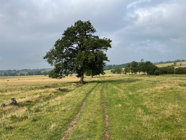
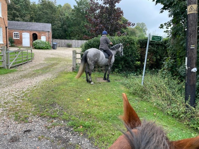
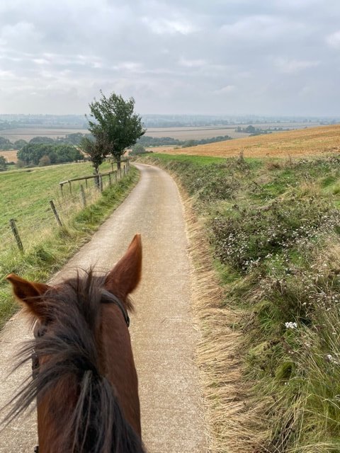
From Bush Lane cross the Cold Ashby road into lane opposite sign posted 'Whitehouse Farm'. At the end of the lane there is a large gate, open and go through onto Byway. Keep following the byway through another two gates, you will probably pass sheep and cattle in this part of the ride and into next field close to Winwick Hall where there are some small lakes.
From Bush Lane cross the Cold Ashby road into lane opposite sign posted 'Whitehouse Farm'. At the end of the lane there is a large gate, open and go through onto Byway. Keep following the byway through another two gates, you will probably pass sheep and cattle in this part of the ride and into next field close to Winwick Hall where there are some small lakes.
Byway approaching Winwick
|
Small lakes near Winwick Hall
|
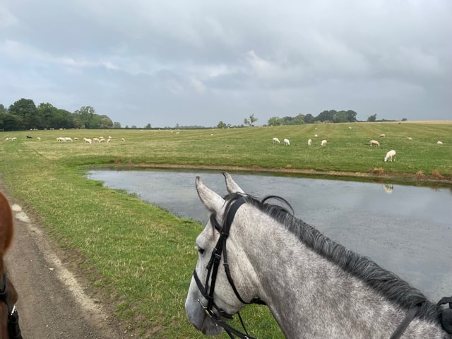
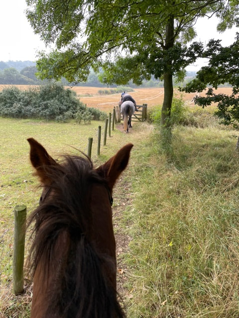
The trail goes round to the right past Winwick Hall to your left, and towards a hedgeline eventually to the left as you near end of field. When you reach the end take the left turn, and several yards further up this left hand track is another gate. Go through gate and follow the trail, hedge on right hand side. You will eventually reach a metalled road that goes to the hamlet of Elkington. Before the metalled road makes a sharp left hand turn in Elkington you will see a sign on the right saying 'Jurassic Way Bridleway'. Follow the sign - the track turns a little narrow at this point.
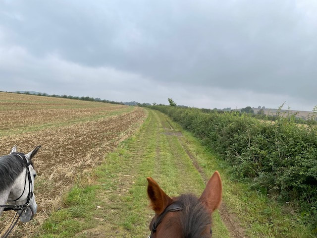
Between Winwick and Elkington
|
Sign to follow at Elkington - Jurassic Way Bridleway
|
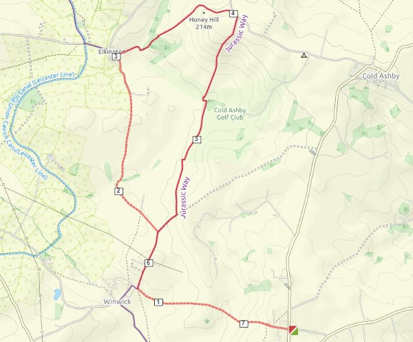
First section is narrow bridge only about 3 ft long, a little spooky so be careful. The track is fenced in on both sides and you'll also pass a horse field on the right as you progress along this section of the route. You'll go through another gate, then downhill to the right diagonally and through another gate. The route then takes you uphill a short distance along a fairly steep narrow track, ride carefully along this section (gorse bushes either side). Follow the route through another gate, which then opens up with a fairly straight run going up a slight incline, you are now approaching Honey Hill. At the end of this section the track narrows again and you'll pass through another gate before entering the main field near to the higher point of honey hill.
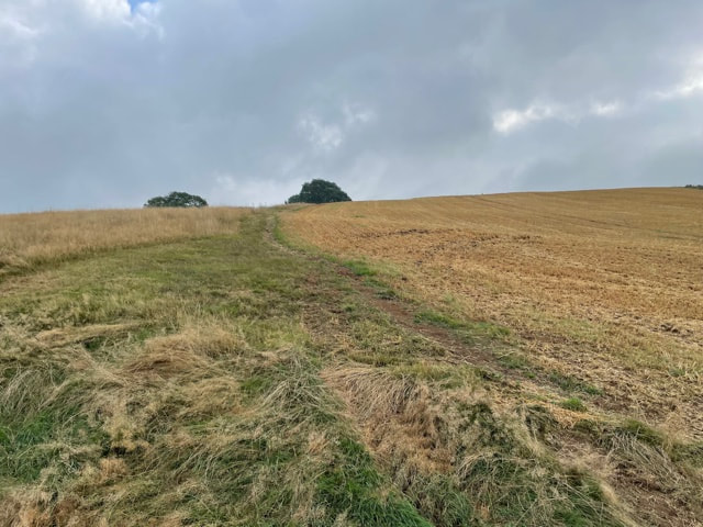
Following track towards top of Honey-Hill
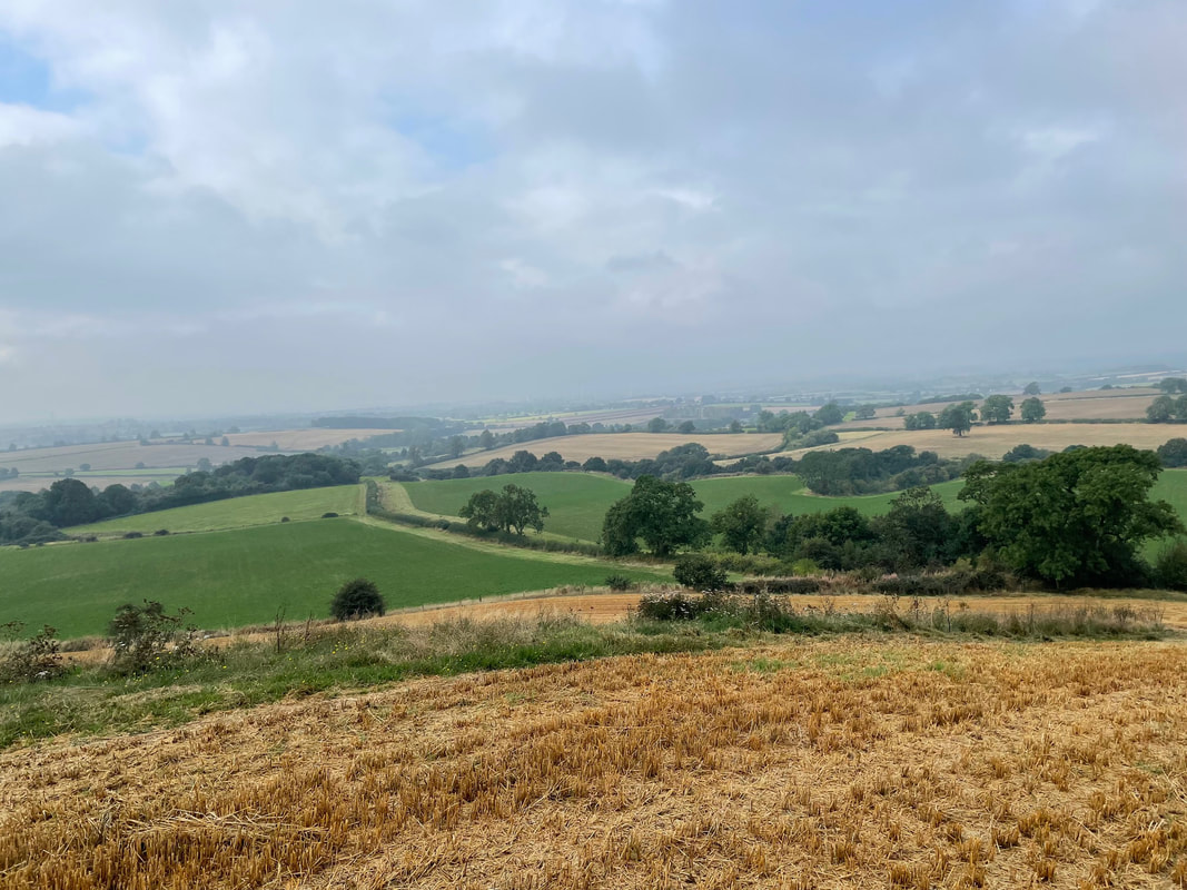
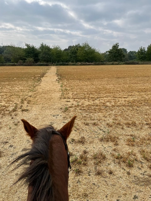
Follow the trail round field to left which then goes round to the right towards the back of the hill. At the point where there's a large stone that commemorates the opening of this part of the Jurassic Way in 1995 on the left hand side, you may wish to go right to the top of the hill. On a good day apparently you can see across to 5 counties.
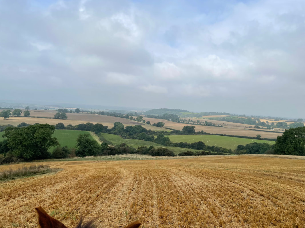
Honey Hill view from top - better on clearer day - photo has no depth
|
|
Otherwise carry on through another gate until you reach the Stanford Road. Take a right at this point and a couple hundred yards there is another sign where the bridleway continues as a concrete track past Honey Hill Farm down the other side of the hill. When you reach a cattle grid there is a large metal gate to the left. Once through, follow track to a bridleway gate and through the edge of a little spinney with trees to the right and horse paddock to left. At the end of the spinney there is another gate which opens up into a field. This bridleway gate is very awkward as there is a track over a ditch the other side. The track behind the gate is due to be made wider by the end of 2021, so it is easier to turn and shut the gate. As there are no livestock you may wish to leave this gate open, and report to fixmystreet if still an issue.
Lane to Honey Hill Farm coming down other side of Honey Hill
|
Gate with Ditch either side behind
|
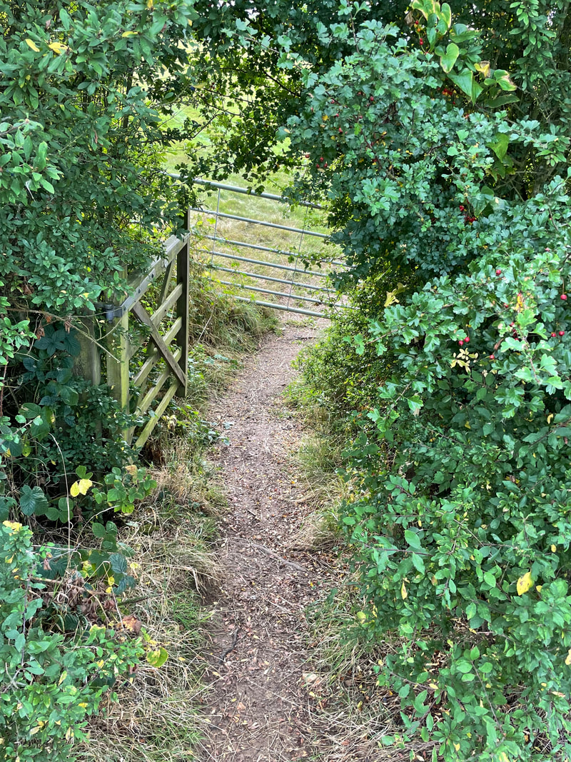
Cross the field opposite and through another bridleway gate into another wooded area, which is part of golf course. At the end of the wooded area there is a quite narrow descent down a bank a short distance so be careful. After this a bit further along, the track descends quite sharply again a short distance into a field. Follow the track across a the field with the continuing parallel with the headland. On the far side is a gate through the hedge with a metal gate the other side. A little awkward, you may want to dismount and mount using gate other side.
|
Awkward gate through hedge, the first gate is due to be removed but is continually open
|
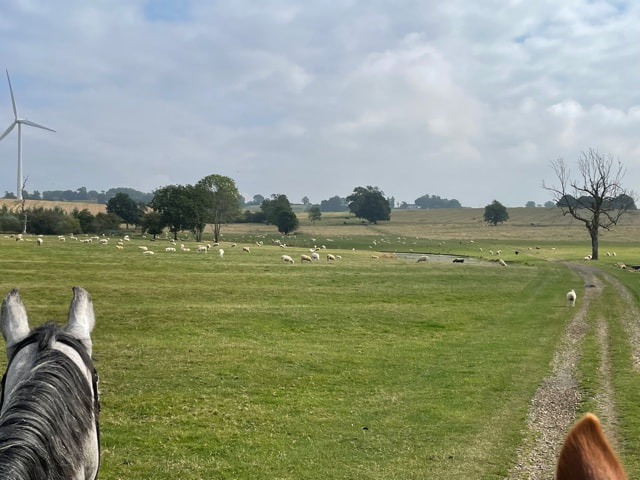
After this gate cross over two fields to another gate and diagonally across the corner of the next field, with large wind turbines to your left and through another gate. At this point you join a byway going back towards Winwick and the lakes. There is another gate before you open the wide field with the lakes, then follow the route back the way you came through WhiteHouse Farm lane and into Bush Lane where you parked.
Back near Winwick Hall lakes on return journey
This ride relates to part of Trail 9 from ‘Northamptonshire on Horseback’, 1995 published by British Horse Society in conjunction with Northamptonshire County Council - ISBN 1-899016-07-4